
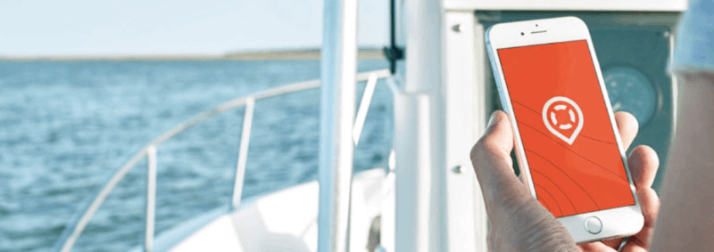
People often rely on devices and tools for a safe trip when sailing on the water. Almost all the functions and features of these tools are integrated into one app – Deckee Boating.
The Deckee Boating app is a boating companion which lets the users obtain weather updates, safety alerts, and maps. The app also has a community wherein members with the same passion for boating can interact.
Learn how the Deckee Boating app becomes a great boating companion with its useful features.
- Getting to Know the Team Behind the Deckee Boating App
- Downloading the Deckee Boating App
- Exploring the Home Page
- Navigating the Maps
- Monitoring the Weather
- Recording the Trips
- Utilizing the Other Features of Deckee Boating

Getting to Know the Team Behind the Deckee Boating App
Deckee is an Australian team that aims to help people stay safe and informed on the water. The team is proud of being diverse as its members have different expertise and hobbies such as boating, data science, design, geospatial technology, and even musical instruments.
Even though the team has various specializations, they have something in common: their interest in water. The team has ambassadors who have a passion for all things water, such as sailing, paddling, fishing, and powerboating.
Having the same passion for water, the team decided to design an app to help boaters explore waterways safely. The team launched the Deckee Boating app in December 2020 to aid people in staying safe and informed on the water.
Discovering the Deckee App
The Deckee Boating app is considered a social app where boaters can get relevant information about waters. Users may receive official safety information alerts from various maritime agencies to ensure safe trips on the water.
Users also can view weather conditions and forecasts near their location to plan their trips accordingly. Moreover, the app allows users to log their trips for record and future reference.
There are also crowdsourced reports from different individuals in the boating community to help each other by guiding them based on their experience.
Downloading the Deckee Boating App
The team described Deckee Boating as the ultimate boating companion app available for Android and Apple mobile users. The Deckee Boating app is free to download from the Google Play Store and the Apple App Store.
Upon installation, the app asks the users to allow Deckee Boating to access the device’s location. Then, people should sign up to join the Deckee community for free. The community helps users connect.
Deckee community ensures that the users are well-informed to stay safe on the water. Users only need to provide an email address to register and sign up. Then, the app sends a verification code to confirm the account.
After verifying the email address, users need to create a profile on the Deckee Boating app. They need to choose a username that will be visible to other users on the public Deckee profile. The app also lets the users add their respective profile pictures.
Creating a Profile on the App
The app wants users to have a personalized experience. It asks for their preferences and interests about water from the pool of options, including fishing, boating, sailing, yacht racing, cruising, paddling, watersports, and other interests.
Deckee Boating also wants to know whether the users have a motorboat, sailboat, personal watercraft, paddle craft, or do not have one. Users with boats can add details like the boat name, watercraft type, boat model, registration number, and call sign.
Users can specify the boat’s length, beam, draft, and capacity. The Deckee Boating app allows users to add as many boats as they have to the system. Moreover, users can upload photos of the boats for other users to see and check.
Exploring the Home Page
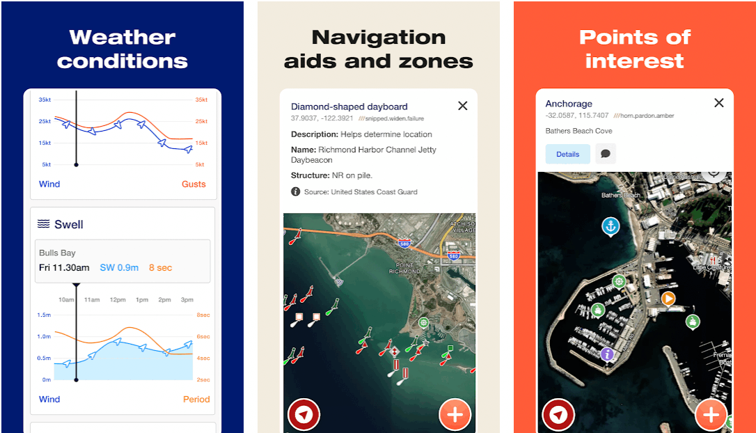
The Deckee Boating app has five primary tabs on its home page: Map, Weather, Record, Notifs, and More. The Map tab is just a basic map that automatically locates the current location, and users may use it to find directions to go to different places.

The Weather tab shows the current conditions of the weather in the user’s current location. Meanwhile, the Record tab covers the logged and saved trips on the water. Various alerts and notifications are found on the Notifs tab.
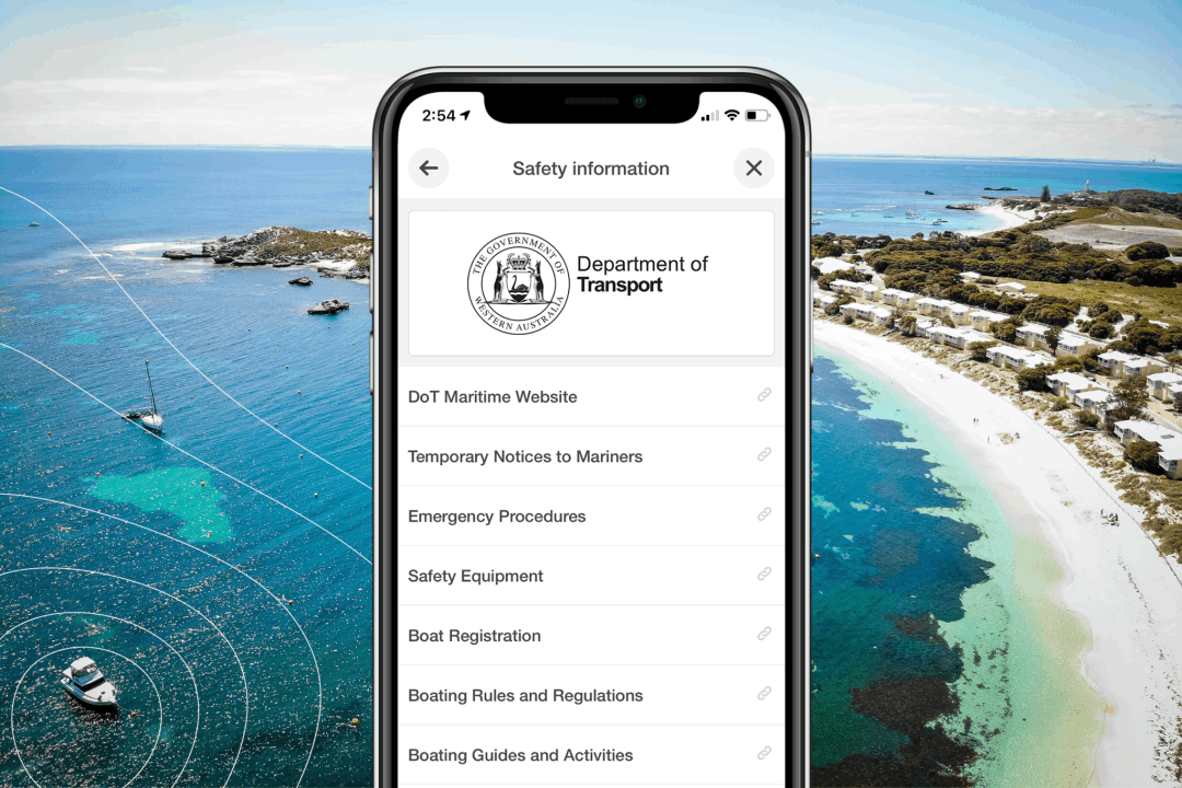
Lastly, the More tab displays the profile of the users and the other important information and features. Here, users may find trips, alerts, measure distance, my reminders, safety information, settings, contact support, etc.
Setting Reminders
Deckee Boating reminds users of the things that need to be done and the expiration date. Users can get a reminder alert about their boat license, boat registration, EPIRB, fire extinguisher, flare, lifejacket, and many more.
Users can also add other reminders, especially for important things when sailing. For example, users can utilize the feature for the things they need for a trip to not forget them.
Navigating the Maps
As mentioned, the Map tab shows a map where the Deckee Boating app finds the current location of the vessel. There are two kinds of maps on the app: terrain and satellite. Users can easily switch between the two maps depending on what they need.
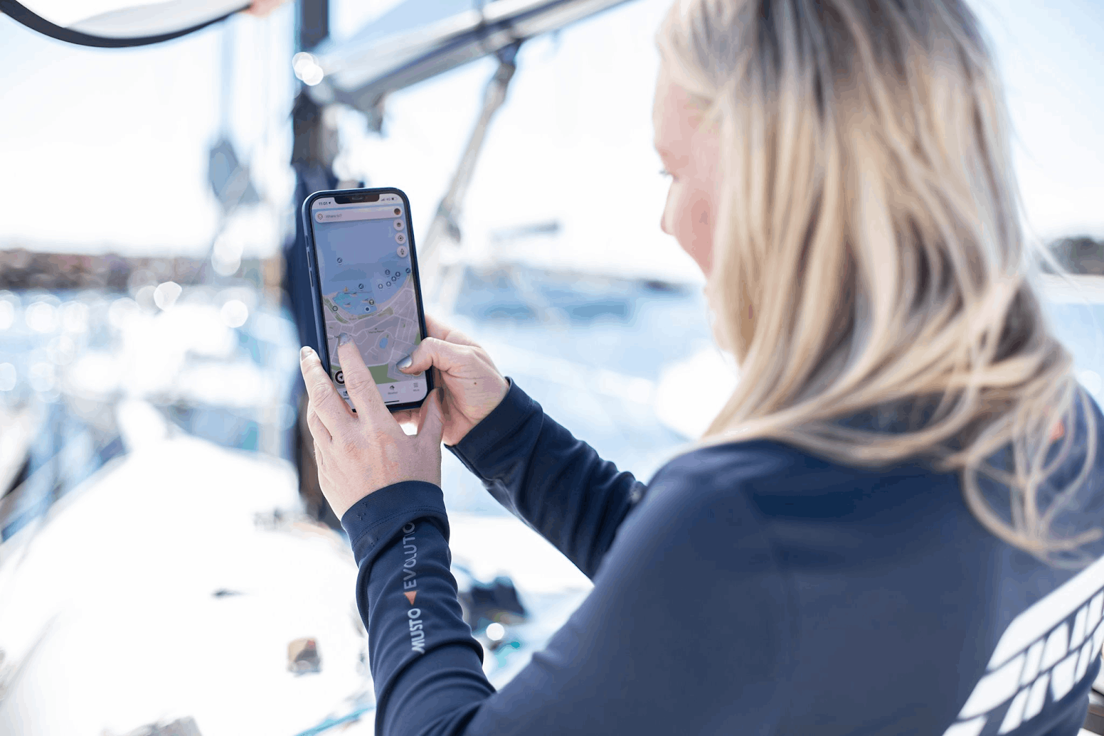
Aside from the directions given by the map, users can use it for vessel tracking.
The map also contains the marine points of interest, which the app automatically locates. Users can find anchorage, diving spots, fishing spots, marine life, mooring, and snorkeling spots.
Users can get general information and navigation information from the app. All the marine points of interest and information can be turned off depending on the users’ preferences.
Other Information on the Map
Moreover, the app looks for different marine facilities nearby that will be shown on the map, such as boat ramps, boat storage, bridges, chandlery, customs and immigration, docks, fuel docks, haul-out facilities, lighthouses, marinas, police, port overview, pump outs, showers, and even toilets.
General services like fuel stations, grocery stores, hardware stores, marine information, and plumbing stores are also present on the Map tab.
Users can search for safety facilities and services nearby. They can find activity areas, aids for navigation, bar crossings, environmental zones, overhead cables or power lines, restricted areas, shipwrecks, speed zones, unsafe anchorage, and webcams.
Monitoring the Weather
The app aims to help users by giving them information about the current weather conditions in the current location or a target location. It also shows the last time the information was updated. Interestingly, the app provides weather updates within seconds.
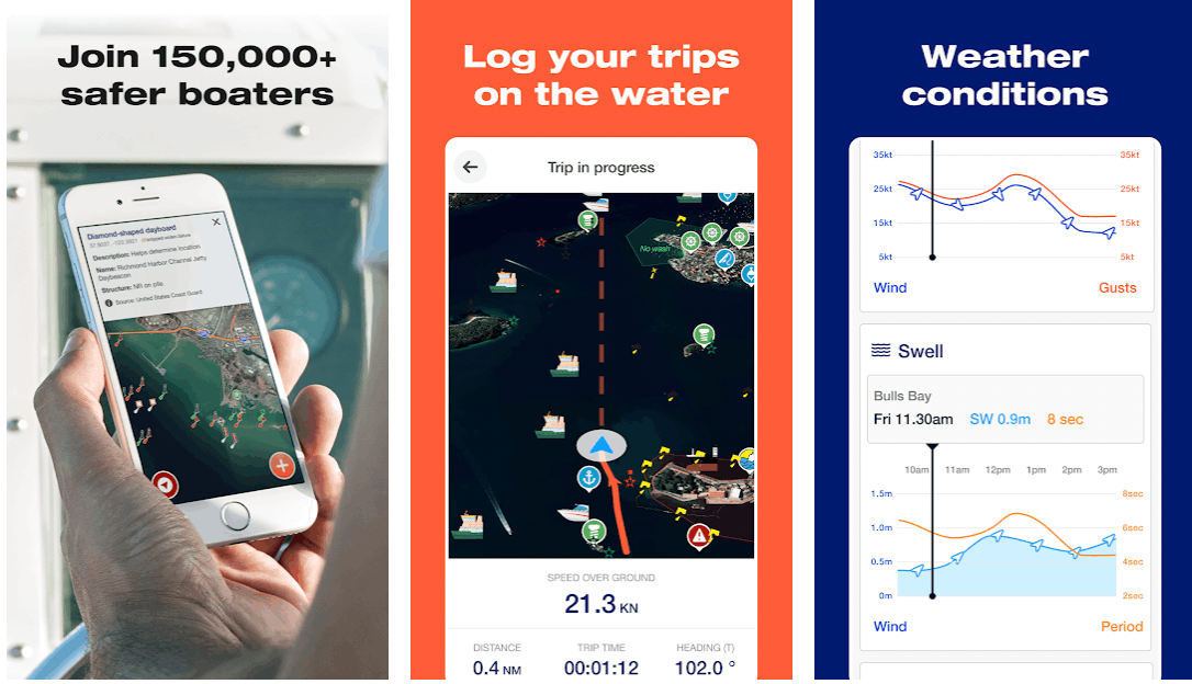
Primarily, Deckee Boating shows the actual temperature of the location and what temperature it feels like. A temperature chart tracks the changes in temperature in the past 24 hours.
Deckee Boating also lists the weather outlook for the next seven days, displaying the temperature and general weather conditions like whether there will be rain, clouds, or clear sky.
Checking Other Weather Conditions
Moreover, the app includes the relative humidity, wind, air pressure, rain today, swell, tide, and moon phases. Deckee Boating provides the speed and the direction of the wind per hour.
For tides, the app shows the expected tide height in meters in the past and coming hours. The rainfall is also recorded in terms of rainfall and the chance of rainfall.
It is a given that the moon affects the height of tides. Thus, Deckee Boating also displays the moon phases. Users may check the visibility of the moon as well a the time the moon will rise and set.
Recording the Trips
Deckee Boating lets the users record or log the trips they take. So, the app asks the users to allow Deckee Boating to use the location in the background even if the app is closed.
Users can do this on the “Record” tab, which shows the speed over ground or water. The distance covered, trip time, and heading are on the tab so that users can get real-time updates on their trip progress.
In addition, users can utilize the map provided on the tab, which also includes the compass for direction and current location. The users just need to click the “Start” button to record the trip.
Visiting “My Trips”
There are more pieces of information that Deckee Boating records in the “More” tab. The app shows the trips made this year and each month through the “My Trips” feature.
Users can check their achievements on how much distance they covered sailing the waters, including the trip time and average speed.
Utilizing the Other Features of Deckee Boating
One of the main features of Deckee Boating is that users can get safety alerts from different maritime agencies. Users just need to register for updates to receive alerts wherever they are.
However, there are places or locations the app does not support, which means the users cannot get alerts.
Users may utilize the “Measure Distance” feature when planning a trip to check how far the target location is or where the users intend to reach at the end of the trip.
Receiving Notifications
The other main tab on the app is Notifs. The app automatically updates the users to receive notifications or alerts from other users. If someone shares content on Deckee with the user, a notification will appear.
Users will not miss out on any activity or interaction with other users. This tab is proof of the Deckee community.
Conclusion
The Deckee Boating app is indeed a great boating companion mobile application. It provides the users with important information for their safety while traversing the waters.
The app contains a map tool, weather condition monitor, and many more useful features when taking a water trip.


